
Can Machine Learning Improve the Accuracy of Water Level Forecasts for Inland Navigation?
Case Study: Rhine River Basin, Germany
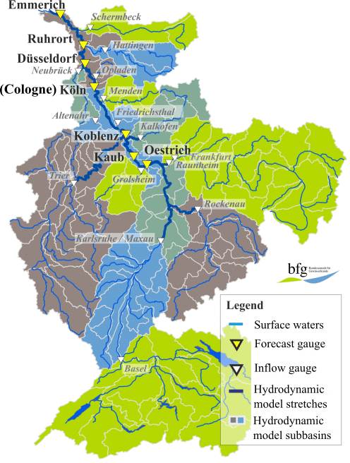
2Unit M2 - Water Budget, Forecasts and Prognoses, Federal Institute of Hydrology
3Digital Mobility, BearingPoint GmbH
In a context where inland navigation traffic in Germany is expected to increase by around 20% by the year 2030 (German Federal Ministry of Transport and Digital Infrastructure, i.e. BMVI), a higher efficiency as well as an optimized logistic, e.g. in traffic management are required. The mFund-founded project Digital Skipper Assistant (DSA) has the aim to develop a cloud-based application, capable to support inland navigation, calculating best routes and Estimated Times of Arrival (ETA). This work contributes to the DSA project, investigating the capabilities of artificial neural networks (ANNs) to forecast water levels up to 10 days ahead in some critical gauges of the Rhine River Basin in Germany. A multiple-output model based on long short-term memory (LSTM) networks was implemented, adopting as input data the water level measurements at the target gauges, as well as the significant ones located upstream to the targets. Sensitivity tests have been conducted varying parameters such as the number of hidden neurons and the batch size. While varying such parameters did not improve the results relevantly, this occurred when the water level forecasts of the hydrological model chain of the German Federal Institute of Hydrology (BfG) were integrated into the optimized LSTM model as additional predictors/input data (the coefficient of determination R2 increased of about 20%). Therefore, the LSTM model have been trained, validated and tested (respectively 80%, 10% and 10%) using historical data from January 2008 until December 2015 and the BfG predictions. Afterwards, the model has been additionally tested in different periods of 10 days each during the DSA field test, running from beginning of July 2018. The results of the tests have been accurately compared with the correspondent BfG forecasts, currently in operation for inland navigation. Considering that Summer 2018 was exceptionally dry - characterized by extreme temperatures in Europe - and, therefore, rather different from the historical training data, the LSTM model integrating the BfG predictions gave promising results. The tests are still ongoing as well as the DSA field test (expected until December 2018). The networks implemented have the potential to be operationally adopted by the German authorities for inland navigation as well as room for improvement.
![Figure 2 - Coefficient of determination R2 [-] over time [d], calculated comparing observed and predicted water levels between the LSTM with the measured water levels as input, the LSTM with the integrated inputs and the BfG hydrological model. R2 [-] equal to 1 means to have got a perfect match between observed and predicted water levels.](https://events.eventact.com/dan/29731/The comparison of R^2 in the three input scenarios (Oestrich) - Copy 1.png)
Powered by Eventact EMS