
Challenges and Considerations to Improve an Inland Navigation Waterway in South America
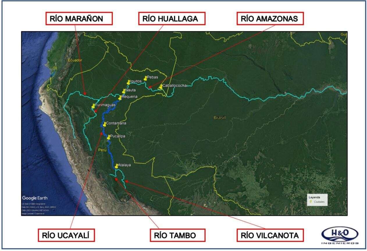
Ucayali River
ABSTRACT:
The Initiative for the Integration of Regional Infrastructure of South America (IIRSA) is a multinational initiative that involves ten countries of South America and its goal is to establish ways of political decision making as well as mechanisms that allow an integration of transportation, waterway river system, and energy and telecommunications infrastructure of the South American Continent. The Peruvian government express its commitment to the development and improvement of navigation conditions on the Amazonian waterways and its neighboring areas. Thus, preliminary studies on the navigability of the Ucayali River were executed, with the objective of building a waterway that attracted the needs of domestic and international trade of neighboring countries, especially Brazil, improving the navigability of the Amazon waterway and enhancing the interconnection of the interior of the continent with the Pacific basin. The Ucayali River which is located in the Peruvian Amazon region and one of the largest rivers in the upper amazon basin is 1850 km long, crosses the region of the province of the same name from south to north, and is navigable from Pucallpa to the confluence with the Marañón by vessels up to feet 6 deep. The Ucayali river flow regime has two distinct seasons: the rising season, which begins in October reaching its highest level in February and March, and the receding season which begins in April and reaches its lowest level in the months of July to September. The Ucayali River presents difficulties to navigation due to its high sinuosity, numerous obstacles, unstable river channel, seasonal variations in water level, highly dynamic transport of sediments, large accumulation of palisades, relatively low slope, presence of channel shoals, formation of numerous islands and sandbars. The purpose of this study is to formulate and evaluate various alternatives or structural methods to improve navigation for the existing and projected cargo fleet; implement a series of improvements to reduce shoaling in the navigation channel, minimize waiting time of cargo ships, attract larger vessels, decrease the risk of accidents, prepare a plan for the operation and maintenance of the navigable channel, and develop the environmental impact study of the proposed alternatives.
KEY WORDS: Inland Navigation, Channel Shoals, Amazonian Waterways, Structural Methods
Powered by Eventact EMS