
Challenges and Considertions to Improve an Inland Navigation Waterway in South America Ucayali River
The interest of the Peruvian government was to adapt to the inland navigation plans carried out by the countries of South America in the environment of the projects of the Initiative for the Integration of the Regional Infrastructure of South America (IIRSA). Thus, preliminary studies on the navigability of the Ucayali river were executed, with the objective of building a waterway that attracted the needs of domestic and international trade of neighboring countries, especially Brazil, improving the navigability of the Amazon waterway and enhancing the interconnection of the interior of the continent with the Pacific basin. The Ucayali River which is 1850 km long, which crosses the region of the department of the same name from south to north, is navigable from Pucallpa to the confluence with the Marañón by vessels up to 6 feet deep. The Ucayali river flow regime has two distinct seasons: the rising season, which begins in October reaching its highest level in February and March, and the receding season which begins in April and reaches its lowest level in the months of July to September. The Ucayali River presents difficulties to navigation due to its high sinuosity, numerous obstacles, unstable river channel, seasonal variations in water level, highly dynamic transport of sediments, large accumulation of palisades, relatively low slope, presence of shoals, formation of numerous islands and sandbars. The purpose of this study is to formulate and evaluate various alternatives or structural methods to improve navigation for the existing and projected cargo fleet; implement a series of improvements to reduce shoaling in the navigation channel, reduce waiting time of cargo ships, attract larger vessels, reduce the risk of accidents, prepare a plan for the operation and maintenance of the navigable channel, and develop the environmental impact study of the proposed alternatives.
KEY WORDS: Inland Navigation, Channel Shoals, Amazon Waterway, Structural Methods
INTRODUCTION
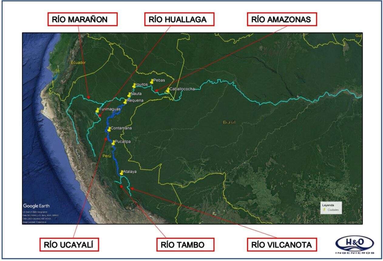
The Ucayali river is in the Peruvian Amazon region. It is a mighty river, of long and sinuous course presenting numerous islands and has a width that oscillates between 2000 and 4000 meters. The study involves the section between the Port of Pucallpa and the confluence with the Marañón River, which constitute approximately 1,850 km of route of main fluvial waterway in the Amazonian plain. The location of the study area can be seen in Figure 1

Powered by Eventact EMS